Kanti Lokpath Road Project
Kantirajpath
Most of the places of Nepal are still under remote area without road, electricity and other essential resources. Even the way to go Kathmandu(capital of Nepal) is not good. likely daily People are killed due to the rough road. Better road represents better transportation links to the neighboring Village, District, Zone and country. It is essential because it covers the rate of growth of economy. There are several way to go Kathmandu but from Birjung, and India border there are 3 main road connection
1. Kanti Lokpath(KLP)- 92km
2. Tribhuvan Lokpath-135km
3. Pritivi Lokmarg via Mugling and Narayanghat-224km
Pritivi Lokmarg:
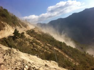
This road is significantly longer than the former two route but it is quicker and easier. We lead Kathmandu from Birjung through Hetuada and then Narayanghadh and then Muglin and finally we reach Kalanki, Kathmandu. But this road is also not good every time. In rainy season the land slide at Krishna Vir will disturb the road too much. and the hill with Trisuli killed too many people. This route is also prone to frequent closer due to slope failures, washouts and blockages by rain during the monsoon season with land slide and flood.
The opportunity at Kathmandu is higher while comparing others. People are come with their dream day by day so the population of Kathmandu valley is increasing day by day and for that reason it needs a reliable link to support the economic development. Which enhance gave rise to the urgent need to redevelop the Kantilokpath(KLP) to make reliable and alternative way to connect Kathmandu with Hetauda for facilitation of goods and services trade with India
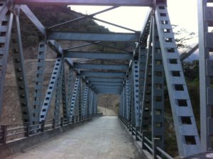
Government of Nepal has established project many time, and during 2065/66 also the made seperate project office to improve existing alignment and to construct. like wise to connect Makawnapur to Lalitpur the made one steel truss bridge over Bagmati river at the border of Makawanpur and lalitpur districk
By the reference of government official site www.dor.gov.np i have mention some information related to the Kantilokpath here below
Tentative Project Cost:
SN Description of Work Quantity Cost (Rs in Thousand)
1 Construction Survey 92 km 2760
2 Earth Work 500000 m3 175000
3 Retaining Wall 90000 m3 427050
4 Black Top 92 km 390800
5 Slab Culvert 10 nos 15000
6 Pipe and Causeway 100 20000
7 Drain (Earthen) 47 km 2500
8 Drain (Masonry) 45 km 110000
9 Bioengineering 92 km 30000
10 Maintenance 92 km 30000
Total Construction Cost of Project 1203110
Project Description:
Project Location: The location of the project is the section of road from Hetauda to Kathmandu. Hetauda is on the mid point of the east-West highway and only 60km north of Birjung, the Nepal-India border town.
Project Started Date: 2065-2066
Estimated Completion Date: 2074-2075
Project Objective: Redevelop and Upgrade the road to make it as a reliable alternative route to connect Kathmandu with Hetauda.
Estimated Cost: Rs. 1,21,91,10,000
Survey/Design : Detail Survey & Design by Korea InternationalCooperation Agency -2003.
Design Standard: Feeder Road (FRN)
Length Of Road: 92 km
Starting Point: Hetauda, Makwanpur (0+000).
End Point: Satdobato, Lalitpur (92+000)
Major River Crossin g: Jitpur & Simat at 31km, Bagmati at 51km and Nallu at 82+400.
Design Standard:
Design Speed: 30 km per hour
Right of way: 30m
Carriageway Width: 5.5m (Intermediate Lane)
Shoulder Width: 0.5 on both Side.
Camber of Carriageway: 3%
Camber of Shoulder: 5%
Minimum Horizontal Curve Radius: 12m
Minimum Vertical Curve Radius/Length: 500m/40
Maximum Gradient: 12%
Average Gradient: 7%
Minimum Gradient: 1%
Vertical Clearance: 5m
Minimum stopping sight Distance: 45m
Maximum super Elevation:7%
Minimum spacing between Center of Hairpins bends:10m
Present status of the Project:
Road Length: 92 km
Makwanpur Sector (Hetauda to Bagmati)- 51 km
Lalitpur sector(Satdobato to Bagmati)- 41 km
Black Top: 15 km
Makwanpur Sector (Hetauda Bajar)- 8 km
Lalitpur Sector (Satdobato to Chapagaun)- 7 km
Gravel Road: 11 km
Makwanpur Sector (Hetauda Bajar Ch 8 km to 12km-Gravel deterioted)
Lalitpur Sector (Chapagaun to Tikabhairab-4km)
Major Bridges: Jitpur & Simat at 31km, Nallu at ch 82+400
Progress of Fiscal year 2065-066:
Construction Survey: 15km ( 82+500 to 71+000, 57+500 to55+000 =14 km Lalitpur sector & 50+000 to 51+000=1km Makwanpur sector.
Fisibility Study: 10km (Jitpur to Thingan)
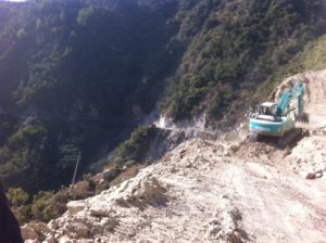
Earth Works :79000 m3 (Road widening from 82+500 to 72+000 =10.5km Lalitpur sector and 50 +000 to 51+000 Track opened Makwanpur sector)
Retaining wall: 8555m3
Sub base: 2270m3
Base course: 490m3(1200m-Makwanpur Sector)
Black Top:12m3 (150m-Makwanpur sector)
Masonry Drain: 400m (Makwanpur Sector)
Budget Allocated : Rs 5,00,00,000
Budget Expenditure: Rs 3,88,91,000
Program of Fiscal Year 2066-067:
Construction Survey: 19km (71+000 to 61+000=10 km Lalitpur sector & 50+000 to 41+000=9km Makwanpur sector.
Earth work :135000 m3 (Road widening from to 72+000 to 65+000=7 km Lalitpur sector and 50 +000 to 42+000= 8km Makwanpur sector)
Retaining wall: 8400m3
Sub base: 7500m3(10km)
Black Top: 260m3 (3km-Makwanpur sector)
Pipe Culvert: 3nos
Slab culvert: 1no
Earthen Drain: 4.5km
Masonry Drain: 1.5m
Budget allocated : Rs 5,00,00
reference with www.dor.gov.np


